
A wall crosses a field, climbs a hillside and disappears behind a ridge. Beyond it, a line of rock stands above the moor. Down in the valley there may be a village, a river and the arches of an old railway. We can enjoy that view without knowing much about it. But once we begin asking how each part got there, an ordinary walk opens into a much longer story.
The Peak District is a particularly good place to follow that story because its changes are often visible. Pale limestone gives way to rough gritstone. A grassy hollow may belong to an old mine. A level walking trail can turn out to be a railway. Even the freedom to walk across some of these hills has a history.
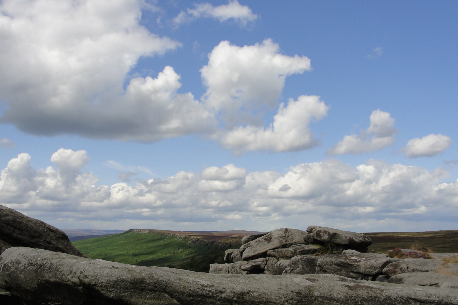

The National Park covers 555 square miles, mostly in Derbyshire but extending into neighbouring counties. Its familiar White Peak and Dark Peak landscapes are joined by the smaller-scale mixture of moorland, farms and valleys in the South West Peak. Each rewards a slightly different kind of looking.1, 25
Before there were hills
The first thing to separate is the age of the rocks from the age of the scenery. The stone in a cliff may be hundreds of millions of years old. The cliff itself is the result of much later erosion. And the National Park boundary is younger than many people alive today.
Much of the limestone of the White Peak began forming during the Carboniferous Period, more than 300 million years ago, when this part of the Earth lay near the equator. Warm seas supported marine life, and lime-rich sediment accumulated on the seabed. Over time, burial and compaction turned it into rock. Fossils preserved in the limestone are evidence of that vanished marine environment. A pale rock face in a Derbyshire dale therefore records conditions very different from those around it now.2
Later Carboniferous environments supplied a different material. Rivers carried sand and mud into a basin as deltas advanced and sea levels changed. Those sediments became layers of sandstone and mudstone. Around Edale and Kinder Scout, the British Geological Survey dates the rocks to roughly 320 million years ago. The coarser sandstones are commonly called gritstone; their rough texture comes from the grains held within the rock.3
Earth movements folded and uplifted these layers. Long periods of erosion removed overlying rocks, exposing older limestone in the central area and leaving younger gritstone around much of its margins. The pattern is not a perfectly tidy ring, but it helps explain why a journey across the park can feel like a journey between different landscapes.2, 4
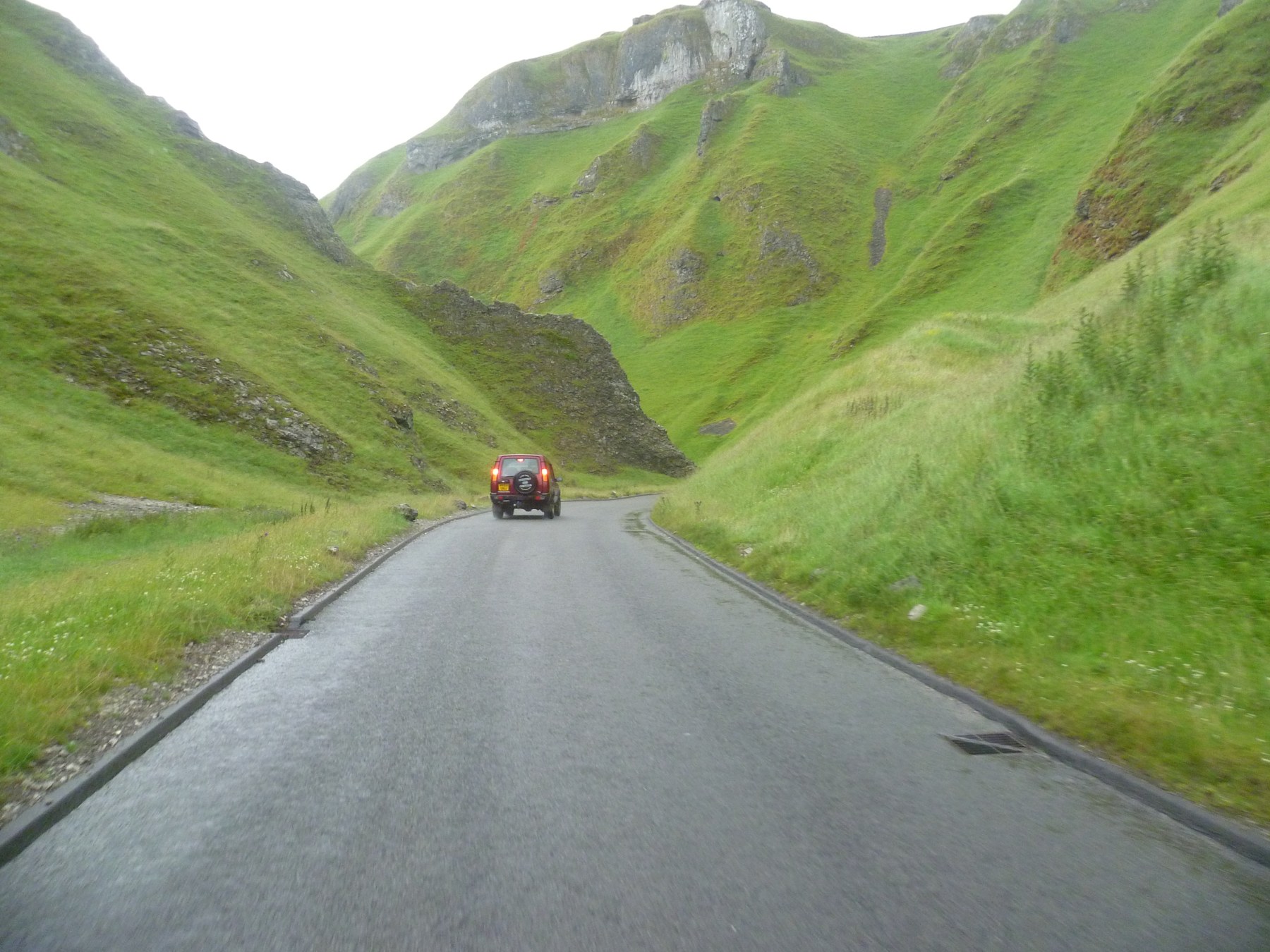

Water continued the work. Rainwater takes up carbon dioxide from the air and soil, becoming weakly acidic. As it passes through cracks in limestone, it slowly dissolves the rock. Over long periods, narrow openings can develop into passages and caves. This helps explain the disappearing streams and underground drainage of the White Peak. When we visit a show cavern around Castleton, we are entering part of a water-shaped landscape that continues below the fields.5, 38
Cold periods also mattered. Glaciation affected the region during its long history, while severe cold beyond the ice sheets broke up rock and altered slopes. The last ice sheet did not simply carve every Peak District valley. Rivers, dissolution, frost and slope movement all contributed, at different times and in different places. The resulting scenery is less easily explained by a single dramatic event than by processes working repeatedly over an immense span of time.4
At Mam Tor, change is especially easy to recognise. The hillside contains a large landslide, more than 4,000 years old, that has continued to move. The old road across it needed repeated repairs before it was permanently closed in 1979. Broken sections of tarmac make an unusually direct connection between geological movement and everyday human plans. A road can be laid across a hillside; that does not make the hillside stable.6
The people before the written records
Human history here reaches back far beyond castles and villages. Caves have preserved evidence of people using the area tens of thousands of years ago. Tools and the remains of hunted animals offer glimpses of lives organised around finding food and shelter in changing conditions. The evidence is fragmentary: it tells us that people were here without giving us a continuous account of their lives.7
Farming brought a different relationship with the land. Woodland clearance, cultivation and grazing gradually changed its appearance. Later prehistoric communities left burial mounds, stone circles and traces of fields. Looking across an open hillside today, we may be seeing the outcome of many generations of work rather than the vegetation that would grow there without people.7
Arbor Low, on the limestone plateau, is one of the most striking places to meet that earlier history. A substantial bank and internal ditch surround fallen limestone slabs. Nearby stands the burial mound of Gib Hill. The stones catch the eye, but the shape and scale of the earthworks matter too: building them required people to organise work and move a great deal of material.8
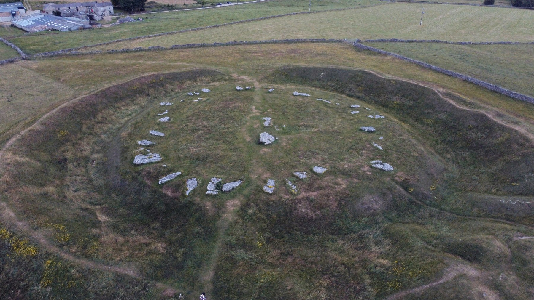

We should leave room for what is unknown. English Heritage explains that the sequence, dates and purposes of Arbor Low and Gib Hill are not fully understood. The complex may have developed through several phases between about 2500 and 1500 BC. We can recognise a place of considerable importance to its builders without pretending to know exactly what everyone believed or what happened at each gathering.8
A visit is more rewarding if we give the earthworks time. Walk around the permitted route, notice the relationship between the bank and the stones, then look out towards the surrounding country. Check the current visitor information before travelling: this is a monument reached across farmland, with access arrangements to respect.40
Forts, farms and the shape of a village
During the Roman period, the Peak District belonged to a much wider network of roads, military administration and trade. At Brough in the Hope Valley, Navio fort began around AD 80. It guarded routes through the region, including a road towards the lead-producing country to the south. A civilian settlement grew beside it. Archaeological evidence includes buildings used for commercial and industrial activity, reminding us that a fort also generated an everyday community around it.9
The landscape continued to be occupied and worked after Roman rule. Medieval villages, farms and fields developed within changing patterns of ownership. Some land was associated with monastic estates; elsewhere, communities cultivated fields and used shared grazing. Much of this history survives quietly, in boundaries and settlement patterns, rather than in a single building with an obvious date.11
Peveril Castle provides a more visible landmark. Established after the Norman Conquest, it stands above Castleton, where the position of the stronghold is still immediately apparent. Its responsibilities included overseeing the royal forest, pasture and valuable mineral resources. The keep was built for Henry II in the 1170s. From below, it can appear to be simply an old defensive ruin. Its history also concerns administration, income and the exercise of power over the surrounding countryside.10
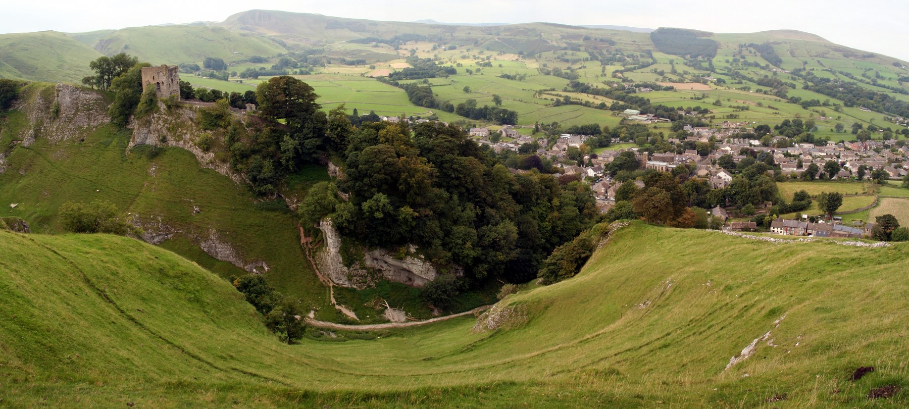

The fields beyond the castle have their own chronology. Some boundaries preserve medieval arrangements, while many of the straight walls dividing the uplands belong to later enclosure, particularly during the eighteenth and nineteenth centuries. Land that had been used in common was divided into individual holdings. Those attractive lines across a hillside record changes in who could use the land and on what terms. We cannot date every wall by looking at it, but we can begin to notice differences in the shapes of the fields.11
Chatsworth offers another view of ownership and work. Its house, gardens and parkland developed over centuries under successive generations of the Devonshire family. The estate’s own history also records the many craftspeople and staff involved. Looking at a designed landscape means looking at decisions: where trees were planted, water directed, buildings placed and views opened. A visit to the house or garden can sit alongside a walk through the wider countryside, with each helping us understand the other.12
Work beneath and beside the fields
Lead mining was once widespread across the White Peak. Its traces are easily overlooked if we expect industry to look like a factory. Lines of spoil, hollows and shafts can interrupt otherwise grassy ground. Miners followed mineral veins, brought ore to the surface and faced the persistent problem of water entering the workings. Drainage tunnels, locally called soughs, carried water away. The ground we admire as a view was also a place where people earned a difficult living.14
At Magpie Mine near Sheldon, the surviving structures make that history more tangible. Workings are recorded from 1740, and the mine continued through periods of activity and closure until its final closure in 1954. Pumping machinery and, later, a long drainage tunnel were attempts to overcome the water problem. The Peak District Mines Historical Society’s account is a useful companion to the site. The engine house and other remains deserve a close look from the permitted surface areas; shafts and underground workings are not places to explore casually.13
Village history also includes disruption that is harder to see in the land. At Eyam, the plague outbreak of 1665–66 is remembered through buildings, graves and the museum. The community’s efforts to limit contact with neighbouring places have become central to the story. Eyam Museum places those events alongside the village’s wider social and industrial history, making it a useful starting point rather than treating the village as a single tragic episode.15, 39
Even a familiar story can change as records are examined. Research presented by the museum identifies at least 700 people living in Eyam when plague arrived, substantially more than an estimate repeated in older accounts. This is a useful reminder when visiting historic places: interpretation depends on evidence, and memorable versions of a story do not always retain every complication.16
Streams powered work as well as shaping valleys. Near Hathersage, Greens Mill was used for lead smelting and later paper-making. Its surviving pond, ruined buildings and tracks occupy a setting that now appears quiet and rural. Paper made there supplied the Sheffield metal trades. Such places connect the countryside with the nearby towns: materials, power and labour moved between them, often along routes now used for leisure.17
Railways, reservoirs and a changing countryside
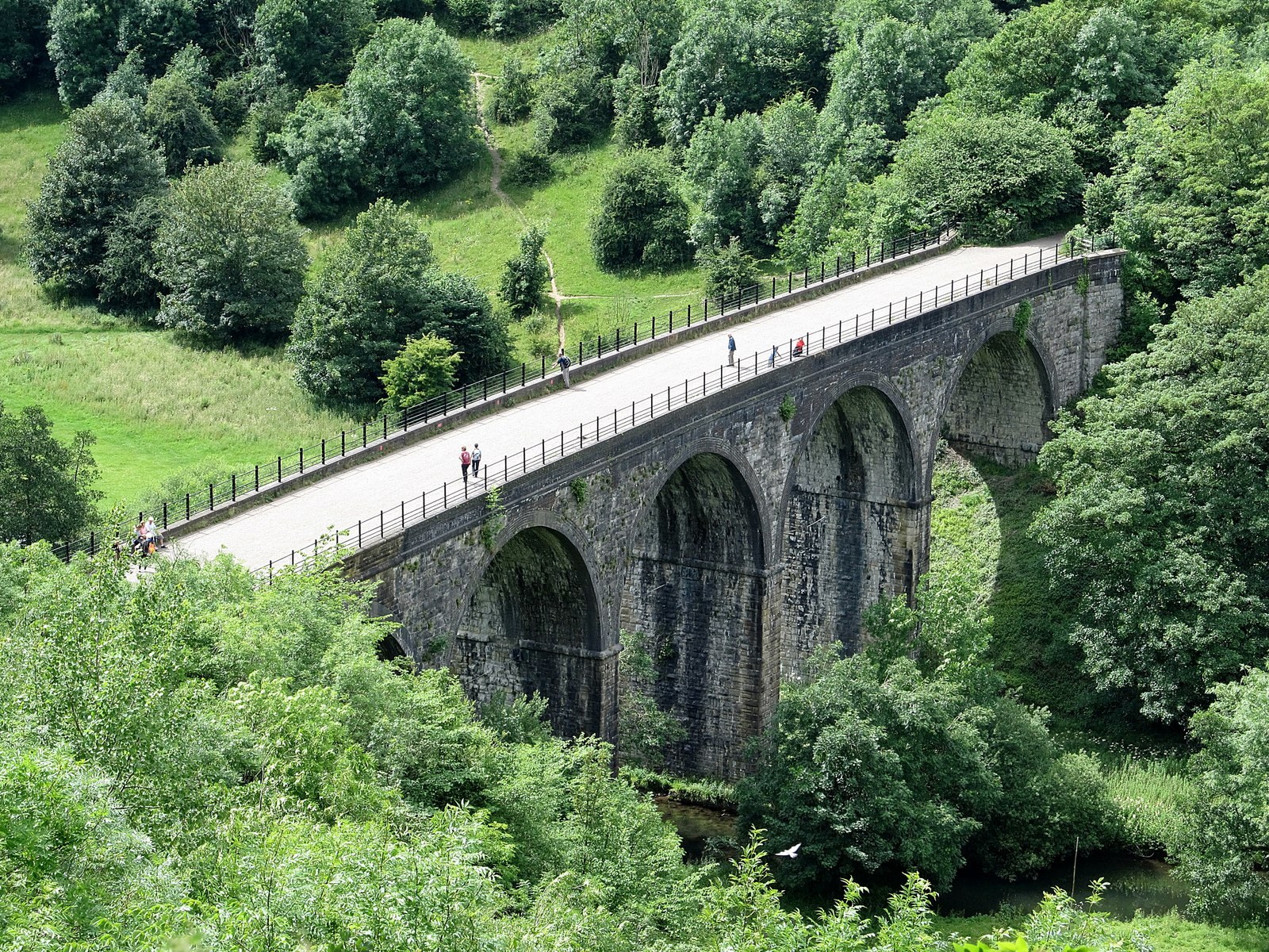
The industrial landscape became more conspicuous with railways. The Monsal Trail follows part of the former Midland Railway through the limestone dales. Tunnels, cuttings and the Headstone Viaduct remain, while the trains have given way to walkers, cyclists and other users. The broad, relatively level route owes its character to the engineering needed for a railway. Its present popularity is another stage in the life of that infrastructure.18

The Upper Derwent reservoirs created another lasting change. Their construction supplied growing urban populations, but also transformed inhabited valleys. Derwent and Ashopton became the lost villages beneath Ladybower. The water and wooded shores are now familiar destinations, yet the view includes the absence of homes, roads and places where people once met. Severn Trent’s visitor information provides a starting point for exploring this history.20
There are connections across the park that a single outing can easily miss. Bole Hill, near Grindleford, supplied stone for the Howden and Derwent dams. Quarrying, transport and reservoir construction linked the eastern gritstone country with the northern valleys. The woodland now growing around old quarry faces can make it difficult to imagine the activity once concentrated there. A peaceful appearance tells us about a place today, but only part of its past.19
Who should be able to walk here?
As people in the surrounding industrial towns sought time outdoors, access to the hills became a contested issue. Much land was privately owned, and walkers could find themselves excluded from places they could see from a road or path. Campaigning took many forms, including organised rambling, negotiation and political pressure. An unsuccessful access bill introduced in 1884 shows how long the argument had already been running before the best-known protest.21
The Kinder Scout mass trespass of 1932 brought that conflict into sharp focus. Walkers, many from Manchester, set out from the Hayfield area and encountered opposition from gamekeepers. Some participants were imprisoned. It became an enduring symbol of the demand for access, especially for people whose working lives were spent in crowded towns and cities.22
It was part of a broader campaign involving walking groups, conservation organisations and people arguing for national parks. The National Parks and Access to the Countryside Act followed in 1949. On 17 April 1951, the Peak District became the United Kingdom’s first national park. In 2026 it reached its seventy-fifth anniversary: a comparatively recent milestone in a landscape whose rocks reach back into the Carboniferous.21, 23
National park status did not transfer the whole area into public ownership. The Authority owns only a small proportion; farms, estates, water companies, the National Trust and other owners hold much of the land. People continue to live and work here. The designation brings a responsibility to care for the landscape and its heritage while enabling people to understand and enjoy it.1
The park we visit now
For residents, the present-day Peak District includes concerns that a weekend visitor might barely notice. Affordable homes, local jobs, transport and access to services all matter. The park’s management plan identifies these as part of sustaining its communities. Supporting a village shop or café, using public transport where it works for the journey and parking without obstructing residents are practical ways of recognising the life behind the visitor experience.24
Wildlife also depends on the details of how land is used. The limestone dales contain flower-rich grassland, woodland and rivers. In the Dark Peak, blanket bog and heath support a different community of plants and birds. The South West Peak brings together smaller patches of moorland, rush pasture, hedges and farmland. A dipper beside a stream, cotton-grass on wet ground or a curlew heard over rough pasture belongs to a particular set of conditions.25
These habitats are not equally secure. The National Park’s State of the Park report describes limestone grassland as internationally important but increasingly fragmented, often surviving on steep slopes where intensive farming is difficult. A green view can therefore conceal very different kinds of habitat, with very different value for wildlife.26
On damaged moors, restoration is visible in planted areas and structures that slow drainage. Moors for the Future Partnership describes work to stabilise bare peat, restore wetter conditions and reintroduce bog plants. Its published guidance explains why sphagnum mosses matter in rebuilding a functioning blanket bog. Healthy peatland protects a store of carbon and influences water movement; repairing it is part of caring for the wider landscape, not simply improving the appearance of a hillside.27, 28, 3
The park’s future will be shaped by these everyday decisions about land, water and access. Walking gives us a way to notice the results, especially if we return to a place at different times of year and allow ourselves to look beyond the best-known viewpoint.
Places to begin, and walks to take
There is no need to fit the whole Peak District into one visit. Choosing a small area and giving it time often reveals more than driving between a succession of famous stops. The following options connect with the history and landscapes in this essay. Distances are those published by the route providers; follow their maps and current notices when planning a walk.
Castleton and Mam Tor
Castleton brings together limestone scenery, show caverns and Peveril Castle, whose approach is steep. For a hill walk, the National Trust’s Mam Tor circular route is 3 miles (4.8 km), starting at Mam Nick car park. It is graded moderate, with steps, steep sections, gates and stiles. The ridge gives views across the Edale Valley, while the route also encounters the broken road. Allow for exposure and slippery ground in poor weather.
Longshaw and Padley Gorge
The National Trust’s Longshaw woodland explorer is a 3-mile (4.8 km) circular walk, graded moderate. It connects the estate with an old packhorse route, gritstone outcrops and the oak woodland of Padley Gorge. There are steep sections and road crossings. This is a particularly useful walk for seeing how woodland, transport routes and past working landscapes sit close together.
The Monsal Trail
The full trail runs for 8.5 miles (about 13.7 km) between Coombs Road, Bakewell, and Blackwell Mill. That is the one-way length, not a circular walk. Choose a shorter out-and-back section to suit the day. Hassop and Millers Dale offer easier access than the steep descent from Monsal Head. Check the access information for your particular needs, and remember that the route is shared with cyclists and other users.
Ladybower and the Upper Derwent Valley
For a shorter visit, the National Park’s Ladybower Miles without Stiles page describes options from Heatherdene: a 400-metre option for dam views, a 1-kilometre dam option and a 1.5-kilometre extension. It distinguishes “Access for All” from “Access for Many”; read the route details rather than treating all three as identical. The descriptions include a road crossing and a pavement section.
The Roaches
In the Staffordshire part of the park, the Roaches offers gritstone ridges and woodland paths. Staffordshire Wildlife Trust’s reserve page is the place to begin planning. There are steep, uneven sections, steps and mud, so choose a route to match your ability. The rocky ridge and the wooded chasm of Lud’s Church provide quite different experiences; they need not be combined into one outing.
Kinder Scout
For experienced hill walkers, the National Trust publishes an 8-mile (12.8 km) mass trespass walk in the Hayfield area, graded challenging, with a suggested five to six hours. It offers a way to connect access history with the landscape itself. Plan for the full route, the weather and available daylight, and carry navigation you can use if visibility deteriorates. Kinder should be treated as a substantial hill day.
Dovedale and Ilam
For limestone scenery beside the River Dove, use the National Trust’s Ilam and Dovedale information to choose a visit. The route from Ilam to the stepping stones includes slopes and uneven ground and is not suitable for pushchairs. The stones can become impassable after heavy rain. A walk here should depend on the conditions, rather than on completing a particular photograph or crossing.
Stanage Edge
Stanage is a good place to see gritstone at close quarters, with the remains of the millstone industry below the edge. Use the National Park’s estate information and a suitable map to choose your approach. The edge is exposed and has substantial drops. A short walk in good conditions can give ample time to study the rock, the abandoned millstones and the farmland below.
For days centred on people and buildings, Arbor Low, Eyam Museum, Magpie Mine and Chatsworth each offer a different route into the past. Check opening, booking and access arrangements directly with the relevant organisation. Some places have seasonal opening or require more walking than a map symbol suggests.
The Hope Valley railway gives access to Grindleford, Hathersage, Bamford, Hope and Edale. This can make a walk from a station a useful alternative to competing for a small car park. Check the current timetable and the connection between the station and your chosen route; the station is not necessarily at the start described by a walking guide.35
The National Park’s Miles without Stiles guides are worth consulting early when planning for wheelchair users, pushchairs or anyone who needs gentler terrain. For every walk, check current conditions, wear suitable footwear and take the clothing and supplies the route requires. Follow signs around grazing animals, wildlife and restoration work, keep dogs under appropriate control and take litter home. Do not light fires or use barbecues.29, 31, 33, 36
Looking again
After a little exploration, the same view begins to look different. We may notice where a wall changes direction, wonder why a path is so level or recognise that a rocky slope has moved. A village becomes somewhere people have adapted to work, illness, ownership and opportunity. The hills remain enjoyable places to spend a day, but there is more to hold our attention.
Much of the Peak District’s interest is available at that ordinary walking pace. We can stop beside an outcrop, follow the line of an old track or spend longer than expected in a village museum. The next question often begins with something small enough to have walked straight past.
Useful organisations and further reading
These are independent sources and visitor resources. Linking to an organisation does not imply its participation in, or endorsement of, this WCW article.
Peak District National Park Authority — Visitor information, current access notices, walking routes, archaeology and the work of caring for the park.
Miles without Stiles — Route-specific information for choosing walks with gentler terrain and fewer access barriers.
British Geological Survey — Start with its Edale and Kinder Scout guide; the Mam Tor case study explains the moving hillside. Follow the numbered references for more detail.
English Heritage — Histories and visitor information for Arbor Low and Peveril Castle. The site histories distinguish what is known from what remains uncertain.
National Trust — Published routes and practical information for Mam Tor, Kinder, Longshaw and Dovedale.
Peak District Mines Historical Society — Industrial history, research and information about Magpie Mine.
Eyam Museum — The plague years alongside Eyam’s wider social and industrial history.
Chatsworth — The house, garden and estate, including research on the people who worked there.
Staffordshire Wildlife Trust — The Roaches reserve, its habitats and information for visitors.
Moors for the Future Partnership — Public explanations of moorland damage, peatland restoration and ongoing conservation work.
Severn Trent Water — Upper Derwent Valley visitor information and reservoir history.
Peak District public transport information — Links for planning rail and bus journeys; check current operator timetables before travelling.
Photographs and reuse
The five photographs in this article are real photographs supplied under the Creative Commons licences shown below. Each source page provides the original download and the licensing record. They are included uncropped, resized proportionally and compressed for the website, without colour changes. Keep the photographer, image title, source link and licence link with each photograph when reusing it.
These licences allow reuse, including commercial reuse, subject to their terms. If a CC BY-SA image is adapted, the adapted image must be shared under the same or a compatible licence. Indicate changes and retain attribution. The licences apply to the photographs; they do not imply endorsement by the photographers or the organisations discussed in the essay.
1. Stanage Edge, Peak District National Park, England — Nessy (2014). Original image and source record · CC BY-SA 4.0
2. Winnats Pass — Anthony Parkes (2011). Original image and source record · CC BY-SA 2.0
3. Arbor Low , Neolithic religious site; English Heritage — kitmasterbloke (2025). Original image and source record · CC BY 4.0
4. Peveril Castle over the town of Castleton, 2008 — Steven Newton (2008). Original image and source record · CC BY 2.0
5. Monsal Head-Monsal Viaduct — Ian Rob (2017). Original image and source record · CC BY-SA 2.0
Image records and visitor sources checked on 17 October 2026. Opening times, access arrangements, routes and transport services may change. Recheck the linked visitor pages when preparing a visit or publication.
Research notes and sources
PDNPA = Peak District National Park Authority; BGS = British Geological Survey. Numbered references support the relevant passages in the essay. Walking entries link directly to their route providers. This article was independently researched from publicly available material; no contribution or approval by the organisations named is claimed.
1. PDNPA — The Peak District National Park, Management Plan 2023–28
2. Peak District GeoWalk — Geology
3. BGS — Edale and Kinder Scout, Derbyshire
4. BGS — The Pennines and adjacent areas, British Regional Geology
6. BGS — Mam Tor landslide case study
7. PDNPA — Landscapes shaped by people, State of the Park
8. English Heritage — History of Arbor Low and Gib Hill
9. Historic England — Navio Roman fort and vicus, list entry 1017505
10. English Heritage — History of Peveril Castle
11. PDNPA — Cultural landscapes, State of the Park
12. Chatsworth — History of Chatsworth
13. Peak District Mines Historical Society — Magpie Lead Mine: its history
14. PDNPA — Lead mining features
15. Eyam Museum — Museum and village history
16. Eyam Museum — Learning and historical research resources
19. National Trust — The history of Bole Hill
20. Severn Trent Water — Upper Derwent Valley
21. PDNPA — History of our National Park
22. National Trust — History of Kinder, Edale and the High Peak
23. PDNPA — 75th anniversary, 17 April 2026
24. PDNPA — Thriving communities, Management Plan 2023–28
25. PDNPA — Wildlife and habitats, State of the Park
26. PDNPA — Habitats, State of the Park
27. Moors for the Future Partnership — Restoring blanket bog
28. Moors for the Future Partnership — Planting sphagnum and moorland plants
29. National Trust — Mam Tor circular walk
30. National Trust — Longshaw woodland explorer walk
31. PDNPA — Ladybower, Miles without Stiles
32. Staffordshire Wildlife Trust — The Roaches
33. National Trust — Kinder Scout mass trespass walk
34. National Trust — Ilam Park to Dovedale stepping stones trail
36. PDNPA — Walking
37. PDNPA — Stanage–North Lees and Stanage Edge
38. BGS — Peak District and Pennine Hills